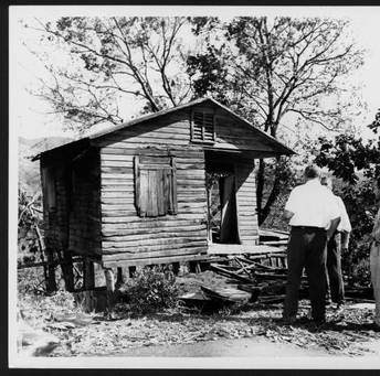
1- HURACAN SANTA CLARA ( BETSY) 1956 HURACANE SANTA CLARA (BETSY) 1956
Ya casi se cumplen 67 años del azote del huracán Santa Clara a la isla, el 12 de agosto de 1956. A continuación, una breve reseña que escribí sobre este evento.
Este huracán categoría 1, es recordado sobre todo porque desde 26 de septiembre de 1932 con el azote de San Cipriano II, la isla no experimentaba el azote directo de un huracán. Según el Dr. Luis A. Salivia en su libro, Historia de los Temporales de Puerto Rico y las Antillas, esa temporada de 1956 comenzó temprano con la visita de la primera onda tropical en el mes de mayo. La primera advertencia relacionada a Santa Clara fue emitida el 10 de agosto de 1956 cuando se localizó como tormenta tropical cercano a la latitud 14.5 grados norte, longitud 55 grados oeste moviéndose hacia el oeste a unas 15 millas por hora. Esa advertencia indicaba que Santa Clara se encontraba a unas 800 millas al este-sureste de San Juan. La advertencia indicaba que Santa Clara a pesar de ser una tormenta tropical pequeña, se consideraba peligrosa. Se les advertía a los habitantes de las Islas de Sotavento y Barlovento que vigilaran el sistema ya que podría ser peligroso para ellos.
El Negociado del Tiempo en San Juan continuó emitiendo advertencias sobre el sistema. Ya para el día 11 de septiembre de 1956 se emitía una vigilancia de huracán para Puerto Rico e Islas Vírgenes. En ese momento Santa Clara se encontraba a unas 450 millas al este-sureste de San Juan moviéndose hacia el oeste-noroeste a unas 16mph. Siguen emitiendo advertencias y es ese día 11 de agosto de 1956 cuando se cambia la vigilancia de huracán por un aviso de huracán para Puerto Rico a las 6pm cuando Santa Clara toma rumbo hacia el oestenoroeste, hacia la isla con vientos máximos sostenidos de 100mph. En ese momento se pensaba que Santa Clara pasaría a una corta distancia del sur de la isla.
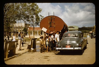
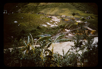
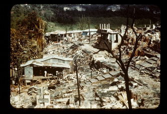
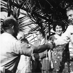
Las advertencias oficiales continuaron y es el día 12 de agosto de 1956, cuando Santa Clara entra a la isla cerca del pueblo de Maunabo a las 8 de la mañana. Se registraron vientos de casi 100mph en la isla, aunque de forma oficial el viento máximo sostenido fue de 90mph, un fuerte huracán categoría 1. Tres horas más tarde, Santa Clara sale de la isla entre el área de Camuy y Hatillo moviéndose a una velocidad de traslación de 21mph. La presión barométrica más baja fue registrada en el área de Guayama con 28.78 pulgadas de mercurio( 978mb). La precipitación mayor fue de 8.7 pulgadas en el área de Rio Grande. Las pérdidas mayores fueron en el área de la agricultura . Se registraron 16 fatalitades y 244 personas heridas. Puerto Rico fue declarado zona de desastre, asignándosele a la isla millones de dólares para su recuperación económica .
Un dato curioso fue el que Santa Clara al entrar a la isla hizo una especie de ziz-zag en su movimiento sobre Puerto Rico y que solamente su paso por la isla fue de 3 horas. También con Santa Clara fue la primera vez en la historia meteorológica de la isla donde se usó el radar por primera vez para seguir la trayectoria de un sistema ciclónico. El nombre de Betsy siguió utilizándose hasta la temporada de 1965.
Los daños causados por Santa Clara fueron cuantiosos. Los pueblos más afectados fueron Yabucoa, Adjuntas, Ponce, Corozal, Utuado, Isabela, San Sebastián, Aibonito, Maunabo, y San Lorenzo, todos con perdidas millonarias. Causo 16 muertes y más de 200 heridos. Puerto Rico fue declarado zona de desastre.
En términos meteorológicos, Santa Clara fue un huracán que dio mucho trabajo predecir su trayectoria, aunque claro hablamos del año 1956. Al principio se había calculado que Santa Clara pasaría a unas 90 millas al sur de la isla, luego se acercó más a unas 70 millas al sur y finalmente el mismo dia 12 de agosto a las 6 de la mañana, se emitió un boletín indicando que Santa Clara entraría a la isla por la zona de Guayama.
Según el Dr. Salivia estos fueron los datos recogidos en esa época. Santa Clara entro por el pueblo de Maunabo a las 8:00AM del 12 de agosto de 1956 y salió entre Camuy y Hatillo tres horas más tarde, a las 11:00AM. . El ojo del huracán media 14 millas y se movió rápidamente a razón de 21mph. El promedio de la velocidad de los vientos fue de 85mph y en la base Ramey en Aguadilla se midieron ráfagas de hasta 115mph. La presión mínima que reporta el Dr. Salivia en su libro fue de 978mb. De forma oficial la NOAA coloca a Santa Clara entrando a Puerto Rico como categoría 1 con vientos máximos sostenidos de 90mph.
El huracan Santa Clara se movió rápidamente sobre la isla a 21mph. El movimiento en “zig-zag”la llevo a pasar por algunas de las mas alta montañas en la isla lo cual provoco que por momentos su ojo no fuera discernible en el radar mas cuando se movio sobre la costa, el ojo volvió a aparecer de forma definida. Dado que la tecnología del radar apenas estaba en sus comienzos, los datos del mismo no se recibían de forma continua y en el caso de Santa Clara en Puerto Rico se recibían imágenes por 3 minutos en intervalos de 15 minutos. Cuando Santa Clara se movió hacia la costa norte de la isla el ojo parecía no mostrar continuidad a la que tenía al entrar a la isla pero dado que no habían imágenes continuas del radar y el fenómeno de reemplazo de la pared del ojo prácticamente no se conocía mucho en esa época no se llegó a conclusiones definitivas relacionado a ese fenómeno.
Además de ser histórico por el hecho de que fue la primera vez que se uso el radar meteorológico en la isla para seguir un ciclón tropical, también fue la primera vez en la isla que se emitió un aviso de huracán por televisión.
No fue hasta el 22 de agosto de 2011 que la isla sufrió el impacto directo de un sistema tropical en el mes de agosto cuando nos azoto la tormenta tropical Irene. Pasaron 55 años entre ambos.
Referencias utilizadas
1. Salivia Luis A: Historia de los Temporales de Puerto Rico y Las Antillas 1492 a 1970. Editorial Edil 1972, p.321-330.
2. Colon Jose A.; METEOROLOGICAL CONDITIONS OVER PUERTO RICO DURING HURRICANE BETSY, 1956 . Montly Weather Review, February 1959, p-69-80.
3. NOAA HURDAT Easy to read database in: http://www.aoml.noaa.gov/hrd/hurdat/easyread-2012.html
Mas informacion sobre sistemas que nos han amenazado o afectado en el mes de Agosto desde el 1900 al 2010 en el documento que escribi hace 2 años sobre el tema.
http://www.huracanespr.net/.../Historia-de-sistemas...
It is almost 67 years since Hurricane Santa Clara hit the island on August 12, 1956. Here is a brief review that I wrote about this event.
This category 1 hurricane is remembered above all because since September 26, 1932 with the scourge of San Cipriano II, the island has not experienced the direct scourge of a hurricane. According to Dr. Luis A. Salivia in his book, History of the Storms of Puerto Rico and the Antilles, that 1956 season began early with the visit of the first tropical wave in the month of May. The first advisory related to Santa Clara was issued on August 10, 1956 when it was located as a tropical storm near latitude 14.5 degrees north, longitude 55 degrees west moving west at about 15 miles per hour. That advisory indicated that Santa Clara was located about 800 miles east-southeast of San Juan. The warning indicated that Santa Clara, despite being a small tropical storm, was considered dangerous.
The Weather Bureau in San Juan continued issuing warnings about the system. As of September 11, 1956, a hurricane watch was issued for Puerto Rico and the Virgin Islands. At that time Santa Clara was about 450 miles east-southeast of San Juan moving west-northwest at about 16mph. They continue issuing warnings and it is on that day, August 11, 1956, that the hurricane watch is changed to a hurricane warning for Puerto Rico at 6pm when Santa Clara heads west-northwest, towards the island with maximum sustained winds of 100mph. At that time it was thought that Santa Clara would pass a short distance to the south of the island.
The official warnings continued and it is August 12, 1956, when Santa Clara enters the island near the town of Maunabo at 8 in the morning. Winds of almost 100mph were recorded on the island, although the official maximum sustained wind was 90mph, a strong category 1 hurricane. Three hours later, Santa Clara leaves the island between the Camuy area and Hatillo moving at a speed 21mph translation. The lowest barometric pressure was recorded in the Guayama area with 28.78 inches of mercury (978mb). The highest rainfall was 8.7 inches in the Rio Grande area. The greatest losses were in the area of agriculture. There were 16 fatalities and 244 injured people. Puerto Rico was declared a disaster zone, assigning millions of dollars to the island for its economic recovery.
A curious fact was that when Santa Clara entered the island, it made a kind of ziz-zag in its movement over Puerto Rico and that its passage through the island only lasted 3 hours. Also with Santa Clara it was the first time in the island's meteorological history where radar was used for the first time to track the path of a cyclonic system. Betsy's name continued to be used until the 1965 season.
The damage caused by Santa Clara was extensive. The most affected towns were Yabucoa, Adjuntas, Ponce, Corozal, Utuado, Isabela, San Sebastián, Aibonito, Maunabo, and San Lorenzo, all with millions in losses. I cause 16 deaths and more than 200 injuries. Puerto Rico was declared a disaster area.
In meteorological terms, Santa Clara was a hurricane that required a lot of work to predict its trajectory, although of course we are talking about the year 1956. At first it was estimated that Santa Clara would pass about 90 miles to the south of the island, then it got closer to about 70 miles to the south and finally on the same day, August 12 at 6 in the morning, a bulletin was issued indicating that Santa Clara would enter the island through the Guayama area.
According to Dr. Salivia these were the data collected at that time. Santa Clara entered through the town of Maunabo at 8:00 AM on August 12, 1956 and left between Camuy and Hatillo three hours later, at 11:00 AM. . The eye of the hurricane was 14 miles long and moved rapidly at 21mph. The average wind speed was 85mph and gusts of up to 115mph were measured at the Ramey base in Aguadilla. The minimum pressure reported by Dr. Salivia in his book was 978mb. Officially, NOAA places Santa Clara entering Puerto Rico as category 1 with maximum sustained winds of 90mph.
Hurricane Santa Clara moved quickly over the island at 21mph. The “zig-zag” movement led her to pass through some of the highest mountains on the island, which caused her eye to be indiscernible on radar at times, but when it moved over the coast, the eye reappeared again. definite shape. Since radar technology was just in its infancy, radar data was not received continuously, and in the case of Santa Clara in Puerto Rico, images were received for 3 minutes at 15-minute intervals.
In addition to being historic in that it was the first time weather radar had been used on the island to track a tropical cyclone, it was also the first time a hurricane warning had been issued on television on the island.
It was not until August 22, 2011 that the island suffered a direct impact from a tropical system in the month of August when Tropical Storm Irene hit us. 55 years passed between them.
References used
1. Salivia Luis A: History of the Storms of Puerto Rico and the Antilles 1492 to 1970. Editorial Edil 1972, p.321-330.
2. Colon Jose A.; METEOROLOGICAL CONDITIONS OVER PUERTO RICO DURING HURRICANE BETSY, 1956 . Monthly Weather Review, February 1959, p-69-80.
3. NOAA HURDAT Easy to read database in: http://www.aoml.noaa.gov/hrd/hurdat/easyread-2012.html
More information about systems that have threatened or affected us in the month of August from 1900 to 2010 in the document I wrote 2 years ago about the topic.
http://www.huracanespr.net/.../Historia-de-sistemas...
